The Handdrawing Map of Rakchu (rags chu) Village in Ngachen (rnga chen) Township Emily Yeh
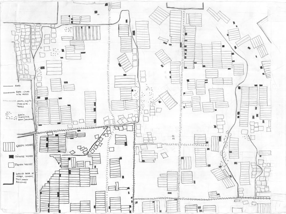
This map of Rags chu village in Rnga chen township was hand drawn by Jeff Lodas. It is roughly to scale. The village extends approximately 1300 meters from north to south and 1150 meters from east to west. Each lightly marked grid block (visible at the edges of the original map) represents 100 square meters. Just north of the three walled areas is Najing (Rnga chen) road. The north-south
Read All